GIS Mapping - Specialized Vineyard Operations
Precision Farming Methods - Vigor and Microclimate Maps
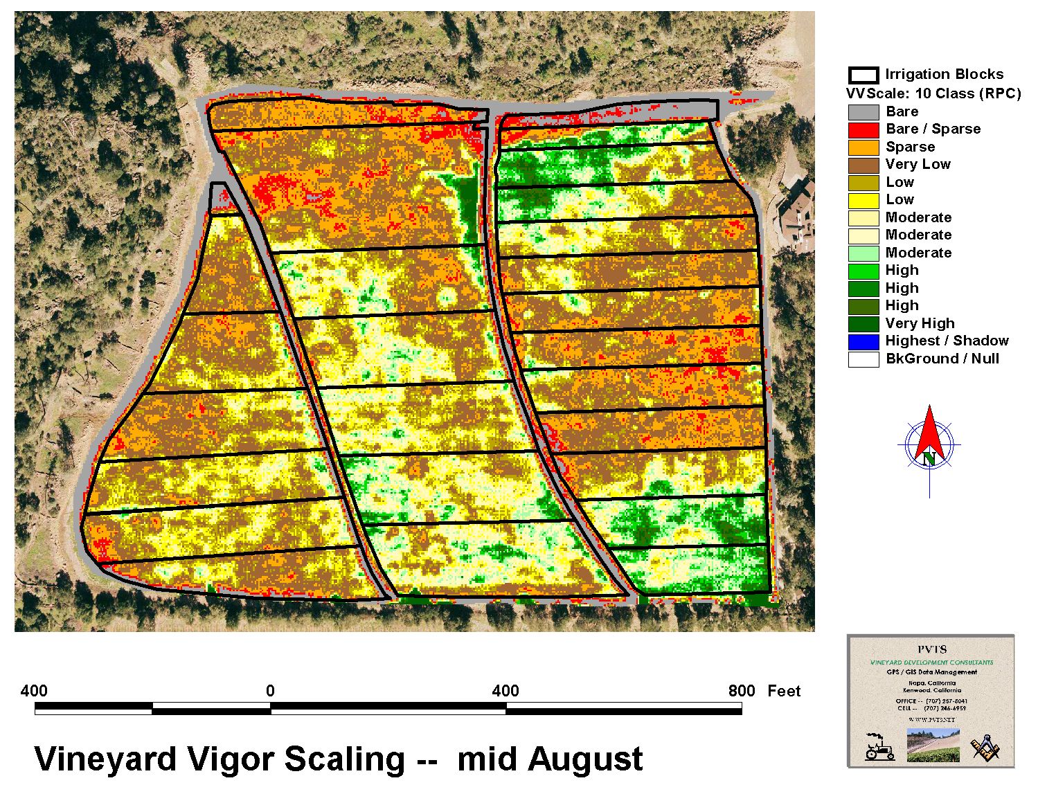
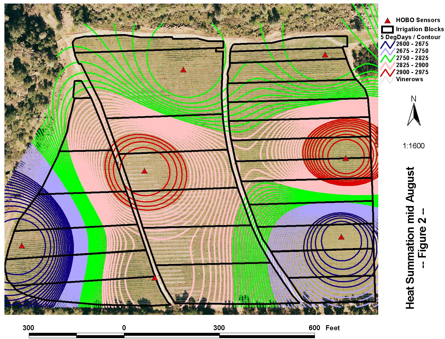
Remote Sensing (RS) false-color imagery has become a common tool used to document vegetative growth patterns in the vineyard and to plan harvest activities. Microclimate sensor-derived cumulative heat scores allow farmers to systematically monitor vine progress and better schedule other growth cycle-dependent measurement events. NDVI-based imagery, microclimate mapping and other vineyard monitoring methods, allow farmers to evaluate irrigation patterns, crop health, crop quality, crop load and harvest timing.
Using vigor mapping and microclimate mapping together, a grower is able to :
identify and find areas of variability in vineyard blocks
more precisely schedule measurement events in the vineyard
verify possible frost damage
monitor disease conditions
locate irrigation leaks
adjust irrigation schedules
better identify where to collect field samples
better plan harvest activities.
In Northern California, we have local, high quality, low cost aerial imagery products that integrate with GIS mapping systems to deliver advanced decision making capabilities to growers and winemakers. PVTS provides high-quality aerial imagery and remote sensing data analysis to our clients. Other custom farming services include the installation of low-cost climate sensors, the creation of data summaries and the production of microclimate maps.
[click each picture for a larger view]