GIS Mapping - Specialized Vineyard Operations
Precision Farming Methods - Annual Comparisons
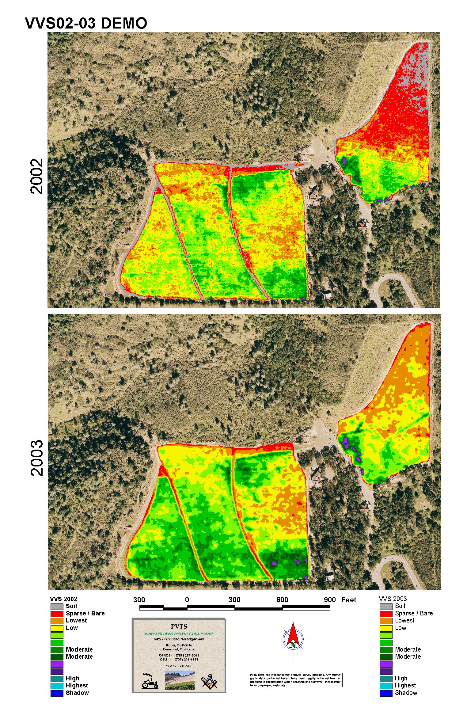
Remote Sensing (RS) false-color imagery has become a routine procedure for harvest planning and documenting the annual vineyard growth cycle. The ability to collect and archive RS imagery as repeated measures across vintages is one of the most common GIS tools employed in viticulture today. PVTS provides high-quality vineyard imagery, vigor models and GIS database tools for crop assessment and harvest planning. These precision farming methods allow vineyard managers and winemakers to address field variability, or more simply put, bring the vines into balance.
In the maps below, the northern portion of the vineyard was planted 2 years later than the southern portion thereby accounting for the overall differences vigor. Further analysis of the images below uncovered root zone penetration into a sub drain area (star markers) necessitating a reduction in emitter size at those locations. Also noted was that areas where trenching occurred during development trap and hold water differently than areas immediately adjacent. Potential over-irrigation in certain areas was investigated and corrected.
[click picture for a larger view]